← All Projects
Robotics · Autonomous Systems

Autonomous AGV Mapping System

A LiDAR-based mapping and localization system for an autonomous industrial guided vehicle.

Year

2024–2026

Status

Prototype

Role

Mapping Software, Sensor Processing, Interface Integration

Duration

Competition & Independent Development
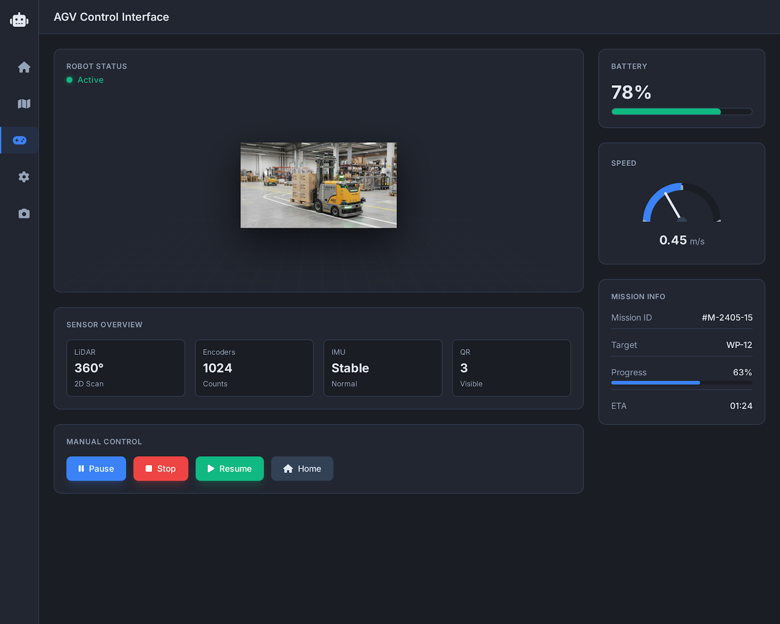
Autonomous AGV Mapping System main interface
Project Overview

Context and objective

This project focuses on real-time mapping, localization and navigation for an industrial AGV. It combines 2D LiDAR scans, wheel odometry, IMU data and QR-based absolute position corrections to build a more reliable understanding of the vehicle's environment.

The Problem

What needed to change?

Autonomous vehicles operating indoors must estimate their position despite wheel slip, sensor noise and changing surroundings. Odometry alone accumulates error, while raw LiDAR data requires alignment before it can be added to a consistent map.

The Solution

How the system responds

I implemented a mapping workflow that converts polar LiDAR measurements into Cartesian points, filters noise, aligns scans with ICP and updates the map over time. Encoder and IMU data support motion estimation, while QR markers provide absolute correction points.

Capabilities

Key features

360-degree 2D LiDAR data processing
Polar-to-Cartesian coordinate conversion
ICP scan matching with KDTree and SVD
Encoder and IMU-assisted odometry
QR-based absolute position correction
Obstacle detection and map maintenance
Dijkstra-based path planning
Real-time robot monitoring interface
My Contribution

Role and responsibilities

01

Developing the LiDAR mapping pipeline

02

Implementing ICP-based scan alignment

03

Combining odometry, IMU and QR positioning

04

Preparing live map visualization and simulation tools

05

Integrating robot data through WebSocket communication

06

Supporting autonomous route planning and mission monitoring

Technology

Tools used in the project

PythonRPLIDARRaspberry PiWebSocketROS 2NumPy
Engineering Decisions

Challenges and solutions

Accumulated positioning error

Wheel-based odometry drifts over time. QR landmarks were introduced as known reference points to periodically correct the estimated pose.

Noisy and moving map points

Raw scans may include temporary obstacles and measurement noise. Filtering and point-age logic help keep the map stable and remove stale points.

Outcome

Results and impact

Built a real-time LiDAR mapping workflow
Combined relative and absolute localization methods
Created simulation tools for recorded sensor data
Integrated mapping outputs with navigation and monitoring interfaces
Project Gallery

Selected screens and system views

Autonomous AGV Mapping System project screen 1
Autonomous AGV Mapping System project screen 2
Autonomous AGV Mapping System project screen 3
Related Services

Need a similar solution?

Continue Exploring

Related projects

Have a similar project in mind?

Let’s discuss the workflow, technical requirements and product direction behind your idea.

Discuss Your Project

© 2026 Doğukan Kıralı. All rights reserved.